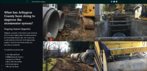
Stormwater Capacity Improvements
For the past several years, the region has experienced annual patterns of repetitive, high-intensity storms (100-year storms and, in some sections of the County, comparable to a 500-year storm). In 2020 and 2022, Arlington County voters approved stormwater bond referenda to help fund watershed-scale projects and local capacity improvements and expansions to mitigate high risk flood areas, as part of a path toward a Flood Resilient Arlington. The County's FY25-34 Capital Improvement Plan also includes significantly increased investment in maintaining and upgrading the stormwater system.
The recently completed Risk Assessment and Management Plan (RAMP) builds on the County's 2014 Stormwater Master Plan and quantifies Arlington's risk from urban flooding. The RAMP uses a risk-mitigation approach to model probability and scale of flood risk, project the influence of climate volatility, and identify flood vulnerability areas and corridors. The RAMP also recommends actions based on the County’s blended-engineering approach under Flood Resilient Arlington and calculates estimated cost for these actions. This watershed-scale, blended approach will include a combination of distributed detention, overland relief through property acquisition, and pipe expansion and tertiary infrastructure.
Due to past significant investments south of Washington Boulevard, adverse flooding impacts in this area of the County have been greatly mitigated. Those investments and actions achieved meaningful flood mitigation through large-scale purchase of floodplains for open space, parks and recreation assets, and the construction of the Four Mile Run Flood Channel as a prominent and effective corridor for overland relief.
 (JPEG, 219KB)
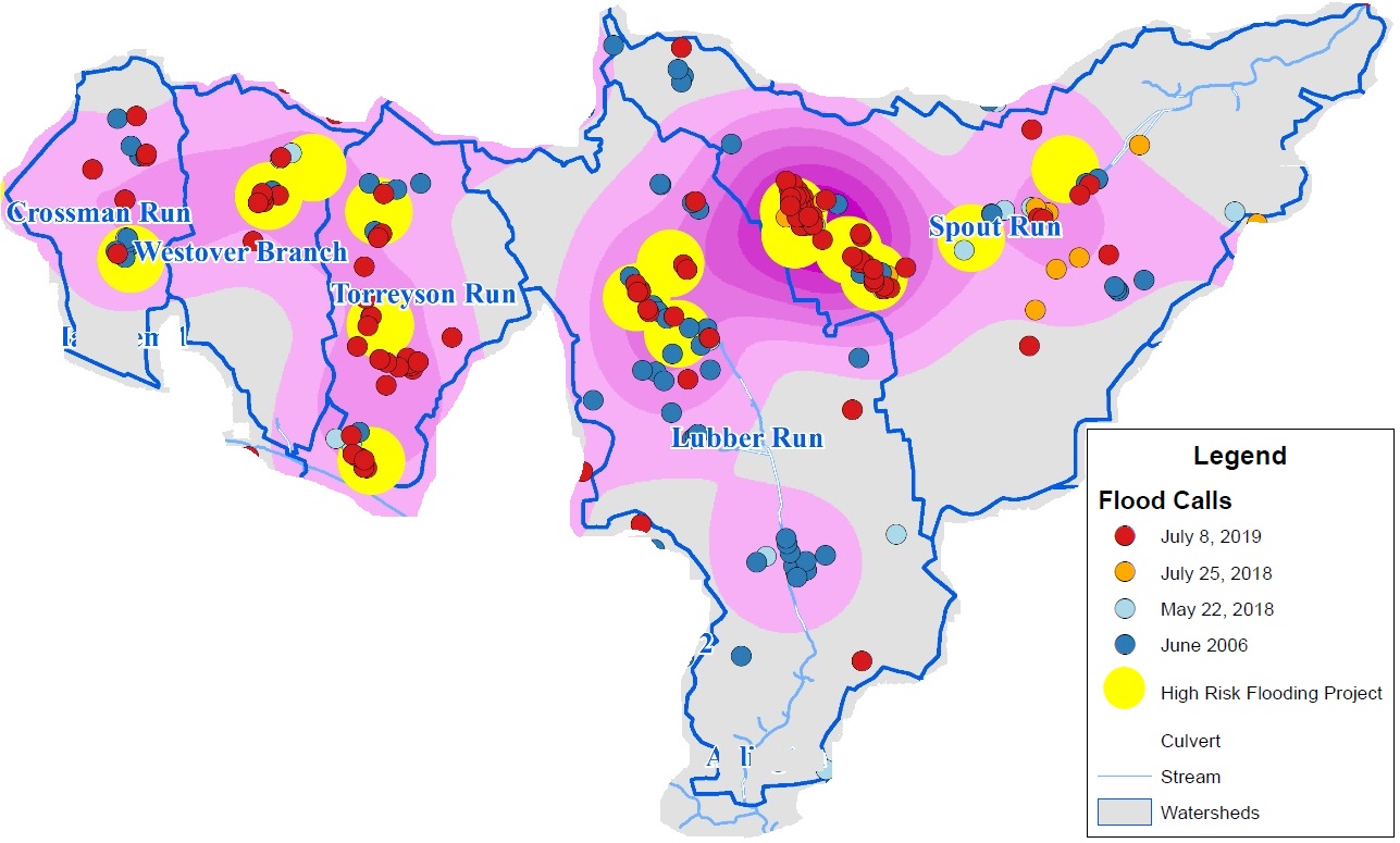
This map shows flood damage calls and high risk flooding projects identified in the Stormwater Master Plan for the five critical watersheds.
North of Washington Boulevard, however, repetitive flooding and loss has occurred. The critical watersheds most in need of stormwater capacity improvements are listed below:
- The Spout Run watershed includes the Waverly Hills and Cherrydale Civic Associations and portions of Ballston-Virginia Square, Lyon Village, Old Dominion, Woodmont and Maywood.
- The Torreyson Run watershed includes the Westover Shopping District, Cardinal Elementary School, and Leeway Overlee, Highland Park Overlee Knolls, Westover Village and Tara-Leeway Heights Civic Associations.
- The Westover watershed includes the Leeway Overlee and Highland Park-Overlee Knolls Civic Associations.
- The Lubber Run watershed includes the Arlington Forest, Bluemont, Waycroft Woodlawn Civic Association, John M. Langston, Glebewood, and part of Ballston-VA Square. It also includes Woodlawn Park and the Virginia Hospital Center.
- The Crossman watershed includes the Arlington-East Falls Church Civic Association near the intersection of N Sycamore St and Lee Highway and a portion of the Williamsburg civic association.
- West Columbia Pike includes the Columbia Forest and Arlington Mill civic associations.
Use the links above to learn more about the system improvements and engagement planned for each watershed.
View a map of County watersheds and civic associations.(PDF, 4MB)
How are projects developed?
For the five critical watersheds, the County has data from the System Capacity Studies conducted for the Stormwater Master Plan which identifies areas in the system needing additional capacity and proposed locations for proposed projects. The recently completed Risk Assessment and Management Plan (RAMP) builds on the County's2014 Stormwater Master Plan and quantifies Arlington's risk from urban flooding. Development of watershed-scale solutions begins with land surveys, research on existing easements, and development of conceptual plans. Modeling is conducted to compare the feasibility and effectiveness of the different conceptual solutions for the watershed. Working on a watershed scale involves analyzing how two proposed projects can jointly reduce flooding risk, as opposed to planning projects individually. Depending on the proposed location for infrastructure improvements, the stormwater management team may need to collaborate or request easements from Arlington County schools, Department of Parks, or private property owners. Land availability, project feasibility and community input are reviewed to help select the most cost-effective options for the watershed. With these and other factors impacting a project, the timing of a project can be driven simply by when all these elements and factors come together.
See the Frequently Asked Questions about Stormwater Capacity Improvements and Watershed-Scale Projects
Learn more about Flood Resilient Arlington.
Story Map: A Flood Resilient Arlington