Upper Long Branch
Location
More than 80 percent of the Upper Long Branch watershed is located outside of Arlington. One-third of the stream channel is within the County. Upper Long Branch flows through Glencarlyn Park.
Drainage Area
Upper Long Branch drains directly into Four Mile Run. The drainage area is 4.7 square miles.
 (JPEG, 2MB)
Drainage area for the Upper Long Branch monitoring site.
Rapid Stream Assessment Technique Scale: Good
Sites along Upper Long Branch scored 32 out of 56. Based on the amount of impervious cover and the results of a detailed stream inventory, Upper Long Branch ranks as one of the “most impacted” watersheds in the County according to the Watershed Management Plan.
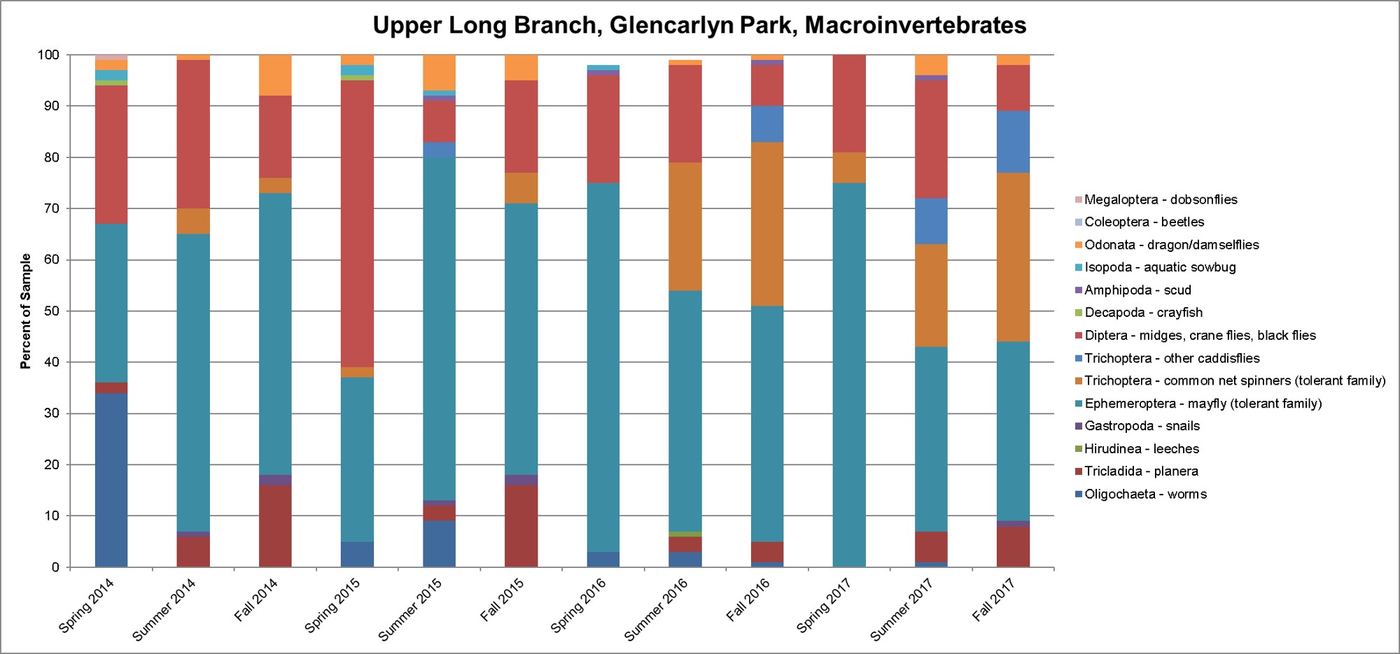
Macroinvertebrate Monitoring Data
There has been a volunteer monitoring station on Upper Long Branch since 2002. The site is located adjacent to Glencarlyn Park, and is downstream from Carlin Springs Road and the Long Branch Nature Center.
Macroinvertebrates commonly found are:
- Midges
- Net-spinning caddisflies
- Small minnow mayflies
In fall 2011 and spring 2012, we contracted a professional monitoring group to collect family/genus-level macroinvertebrate and fish data at each of our volunteer monitoring sites.
 (JPEG, 213KB)
Click on the graph above for an enlarged version.
Bacteria Monitoring Data
There is one bacteria monitoring site on Upper Long Branch, located downstream of Carlin Springs Road and the Long Branch Nature Center. Learn more about bacteria monitoring data.